
Due diligence · Sunshine Coast
How to screen a Sunshine Coast infill site before paying for design
A practical infill site screening method: map usable space, test access and drainage together, compare layouts and decide what evidence to commission next.
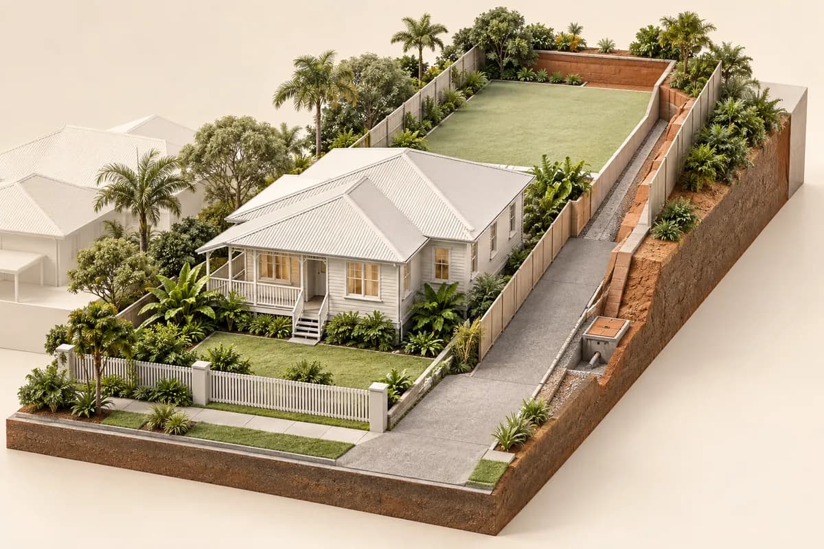
Concept illustration
Project question?
Check the civil constraints before committing to your next step.
Send CivilCity the address, current plans, approval stage and the issue you are trying to resolve. We will help scope the right civil engineering input for the project.
Quick answer
Screen an infill site by testing the space that remains after access, drainage, services, level changes and retained structures are accounted for. Start with one shared base plan, identify the constraints that could change the development outcome, and compare more than one layout before commissioning detailed design.
The useful output is a short, evidence-based brief: a constraint sketch, the options worth testing, unresolved questions and the next investigation. An attractive concept is not enough if the driveway, drainage outlet and service corridors have each been assumed to occupy the same space.
Why infill sites need a different first pass
An infill project sits between established properties and infrastructure. There may be little room to adjust driveway levels, widen a construction route or move a service connection. A neighbour’s finished yard, the existing road and a retained house can fix the edges of the problem before your designer has drawn a new building.
Begin with the intended project: a rear lot, a duplex, townhouses or a small commercial use. Each places different demands on access, servicing and outdoor space. Do not use one generic sketch to infer that every alternative is feasible. Record what is optional and what must remain, especially existing dwellings, vehicle access and occupied premises.
This screening method is useful beyond the Sunshine Coast, but the applicable planning controls, assessment pathway and utility requirements are local. For a Sunshine Coast property, use the correct Council records and proposal-specific advice. Do not transfer a result from another Australian council or from a nearby development without checking the differences.
Put every discipline on one base plan
Collect the survey, title information, available service records, relevant approval drawings and an aerial image. Use the aerial for orientation and the survey for measured relationships within its scope. If the survey does not include a critical road level or drain, identify that gap before relying on a preliminary grade.
Mark fixed features first: boundaries, retained buildings, visible infrastructure, known easements and significant level changes. Add uncertainty as a separate layer. An unverified pipe location should look different from a surveyed asset. This prevents a sketch from acquiring false authority as it passes between consultants.
Keep one issue list with the plan revision. Record questions such as “confirm whether this corridor can accommodate both access and drainage” rather than telling each consultant to solve a separate component. Good screening is coordination: the parts must fit together on the same site.
- Identify the proposal and features that must be retained.
- Mark measured constraints and label unverified information.
- Show potential access, drainage and service routes before refining building footprints.
- Record clashes and the evidence needed to resolve them.
- Issue the same revision to the planner, surveyor, designer and engineer.
Calculate usable space by drawing the constraints
Gross site area does not describe the area available for buildings or new lots. An access corridor, drainage route, retaining structure or service protection requirement can divide otherwise generous land into difficult shapes. Ask where these elements overlap, where they need separation and whether maintenance remains possible.
A simple subtraction of area is also insufficient. A narrow remnant at the wrong level may be less useful than a smaller, well-connected building area. The aim is to understand the arrangement of space, not to produce an apparently precise yield from incomplete information.
| Space to reserve or investigate | Question for the concept | Typical interaction |
|---|---|---|
| Vehicle access and manoeuvring | Can the intended vehicles reach and use the site? | Turning areas compete with parking, landscaping and building edges |
| Stormwater and overland flow | Where does water go during and after development? | Surface routes and structures affect pads and shared corridors |
| Service routes | Can each building or lot be served and maintained? | Pipes, boundaries and retaining structures may conflict |
| Level transitions | Where can the road, buildings and neighbouring ground meet? | Retaining and driveway transitions use more than a line on plan |
| Construction access | How can materials and equipment reach the works? | A workable finished layout may have a difficult construction sequence |
Read a section through the site, not just a plan
A longitudinal section follows a route through changing levels. Even a preliminary section can expose a conflict that a plan hides: a driveway rising beside a retained floor, a drain needing to cross a higher service, or a building pad that forces retaining along a boundary. The engineer needs suitable levels before drawing meaningful conclusions.
Compare the road tie-in, driveway, parking area, building entrance and drainage outlet. Do not resolve one by moving it independently of the others. Raising a pad may improve one drainage route while steepening access or increasing retaining. Lowering a driveway may create a collection point for runoff.
At screening stage, the question is whether there is a plausible coordinated level strategy and what evidence is needed to test it. Avoid presenting preliminary sections as construction documents. Detailed geometry, drainage performance and structural design belong to the appropriate later scope.
Keep three water questions separate
First, where will runoff generated by the development go? Second, does external overland flow need to pass through the site? Third, do flood-related constraints require further investigation? These issues interact but are not interchangeable. A proposal to add a tank does not, by itself, answer all three.
For an infill site, downstream infrastructure may already serve several properties. An existing visible pit is a reason to obtain information, not evidence of permission or capacity for a new discharge. Establish the outlet, levels, downstream arrangement and relevant assessment requirements before fixing the layout around a convenient connection.
If a drainage option crosses neighbouring land, keep the physical solution and permission pathway as separate open items. A route can be technically possible and still unavailable to the project. Ask what the fallback layout would be if that option cannot be secured.
Example: retaining the house changes the whole layout
Consider a deep residential property with an existing house near the front. The owner wants to keep the house and build behind it. The first sketch shows a driveway down one side, new buildings at the rear and drainage returning to the street.
A screening review notices that the side corridor is also the proposed service route. It narrows beside the house, and the rear ground is lower than the street. The team now has two connected problems: usable corridor space and an unverified drainage level strategy. Simply reducing the building width does not necessarily resolve either.
Option A retains the house and investigates a revised access and servicing arrangement. Option B changes the development concept so the corridor and building levels can be reconsidered. Neither option is selected on appearance alone. The team first identifies the measurements and authority advice that would distinguish them.
If the required evidence rules out the retention concept, the owner can compare a different scheme before paying for detailed design of the original one. If the concept remains plausible, the next commission has a clear brief. The value of screening is that it changes the next action, rather than merely adding a list of risks to the file.
Compare options against the same questions
An option comparison should show the trade-offs, including obligations outside the site. Avoid declaring the layout with the most dwellings the best before testing its works scope. A higher yield can involve more retaining, complex servicing or a construction sequence that affects the retained property.
Use the same level of evidence for each option. Comparing a fully investigated layout with an optimistic sketch rewards uncertainty. Label what is known, what is an allowance and what has not been tested. Ask which unresolved item could reverse the apparent preference.
| Comparison | Option with retained house | Alternative layout |
|---|---|---|
| Access | Test the corridor beside existing structures | Test the revised entrance and circulation |
| Levels and drainage | Check whether retained levels constrain the outlet strategy | Check earthworks and boundary impacts of changed levels |
| Services | Identify existing connections to retain, alter or protect | Identify the new route and connection scope |
| Construction | Explain how works affect occupation and existing access | Explain demolition, staging and temporary access assumptions |
| Decision evidence | List what could prevent retention | List what could make the alternative impractical |
Check the local records without mistaking them for a design
Development.i is useful for property information and past or current applications. Investigate the subject property, then use nearby records to understand questions that may be relevant. Read the actual decision and drawings before drawing conclusions from an application title. A neighbouring approval is context, not a guarantee of the same outcome.
Keep current and proposed planning provisions clearly identified in the project file. Council publishes information about its proposed planning scheme separately. Have the planner confirm the provisions and pathway relevant to the site at the time of the decision; do not mix mapping from different versions in a feasibility conclusion.
Where a constraint remains unclear, ask a targeted question with a marked-up plan and the intended proposal. “Can I develop this property?” is less useful than a question identifying the access arrangement, unresolved issue and alternative under consideration.
What to commission after screening
Commission the next package around the controlling question. Missing levels may call for a targeted survey brief; uncertain servicing may call for proposal-specific utility advice; an unresolved layout relationship may call for coordinated concept work. There is no advantage in ordering every possible report before knowing what decision it will inform.
Ask the civil engineer and designer to agree the interface between concept work and detailed design. Council identifies access, parking, roads, stormwater and frontage works among matters that may involve operational work approval. A screening sketch should therefore identify potential later work without pretending that those approvals or details are already complete.
Common mistakes on constrained infill sites
Copying the density of the property next door ignores differences in levels, outlets, access and retained structures. Measuring a corridor from a marketing plan can hide the constraint that controls the whole project. Asking for a firm construction price from a sketch with no level strategy moves uncertainty into exclusions rather than removing it.
Another common failure is preserving a preferred building layout while forcing the civil design around it. When access, drainage and services cannot fit, revisit the concept together. The cheapest drawing change is often the one made before each discipline has completed a separate detailed package.
Checklist for your project brief
Give CivilCity the information needed to screen the spatial and level relationships, together with the decision you want the screening to support.
- Property address and intended use, including whether existing buildings will remain.
- Survey and available plans, with the date and revision of each.
- A marked-up sketch showing proposed access, buildings and known drainage features.
- Available title and service information, identifying anything unverified.
- Photographs of the street frontage, side corridors and changes in level.
- The alternatives you would consider and the next decision or design commitment.
When to involve CivilCity
Bring CivilCity into the concept discussion before the layout becomes fixed. Request a screening scope that tests access, levels, drainage and servicing together and explains the evidence needed for the next stage. Share the result with the planner, surveyor and designer so the next drawings respond to one coordinated brief.
Common questions
Can I screen an infill site using an aerial image?
An aerial can help orient a discussion and identify visible features. It cannot reliably establish boundary positions, critical levels or buried services. Use it to frame questions, then obtain the evidence needed to answer them.
Does a large block necessarily support more dwellings?
No. The shape and arrangement of usable space matter alongside planning requirements. Access, drainage, services, retained structures and level transitions can constrain the layout even where the gross area appears generous.
Should I retain the existing house?
Compare retention and alternative concepts using the same evidence. Include access, services, drainage, construction staging and the effect of fixed floor levels. The engineering comparison informs the wider planning and commercial decision; it does not decide it on its own.
What should the screening deliver?
A defined proposal, marked-up constraints, realistic options and an investigation list tied to decisions. It should clearly distinguish confirmed facts from assumptions and explain where further assessment or detailed design is needed.
Official sources and further guidance
- Development.i: property information and application history
- Council: understanding the proposed planning scheme
- Sunshine Coast Council: operational work
Use the current requirements for your property and proposal. Illustrative scenarios describe possible design issues; they are not reported client projects.
Discuss your project
Find out which infill layout is worth developing
Send your address, available survey and concept, and tell us what must remain. CivilCity can scope a review of the access, drainage, services and levels before you commit to detailed design.