
Local development · Sunshine Coast
Buderim sloping sites: driveway, drainage and retaining risks
A practical civil engineering guide to testing slope, driveway grades, stormwater, retaining and buildable levels on Buderim development sites.
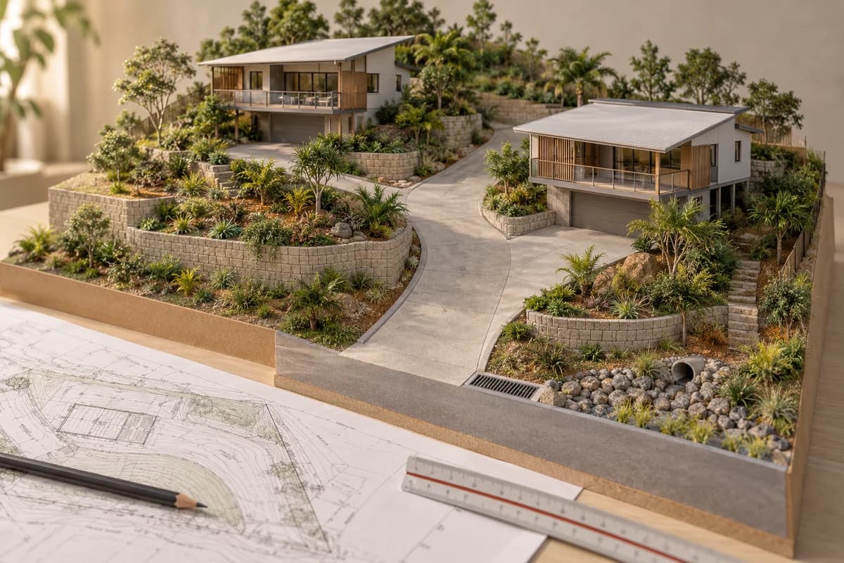
Concept illustration
Project question?
Check the civil constraints before committing to your next step.
Send CivilCity the address, current plans, approval stage and the issue you are trying to resolve. We will help scope the right civil engineering input for the project.
Quick answer
On a sloping Buderim site, the first civil decision is not where to place the retaining wall. It is whether the road connection, driveway, building pads, stormwater outlet and boundaries can work as one level strategy. A concept that fits in plan can fail in section through excessive driveway grades, inaccessible drainage, unstable cuts, large retaining interfaces or a finished floor that cannot be serviced by gravity.
Before committing to detailed architecture or a feasibility yield, obtain a current feature and level survey and test at least one long section from the road to the proposed pads and discharge point. The practical result should be a decision to proceed with targeted investigations, revise the concept, or stop before slope-related cost becomes embedded.
Why Buderim slope changes the development question
Buderim includes established streets, ridgelines, side slopes and pockets where road, property and drainage levels do not align neatly. Retaining an existing dwelling can leave a narrow access corridor; placing new dwellings upslope can increase cut and fill; placing them downslope can make drainage and construction access harder. The civil risk is the interaction between those choices.
Start with the Sunshine Coast Planning Scheme, Council mapping and the available property and approval record. Then test what the information means on the actual site. A mapped slope or hazard is a reason to investigate, not a measured design parameter or proof that a particular wall, driveway or development outcome will be accepted.
Buderim slope-screening decision table
Use this table before fixing the building footprint or pricing earthworks.
| Question | Evidence to seek | Decision it may change |
|---|---|---|
| Can vehicles reach the site and buildings? | Road levels, frontage, grades, turning, sight distance and pedestrian interface | Driveway alignment, parking, dwelling position or yield. |
| Can the pads sit at workable levels? | Survey, cut-and-fill sections, retaining interfaces and finished-floor strategy | Building locations, floor levels, excavation and wall scope. |
| Where does water go? | Low points, overland flow, outlet levels, roofwater, hardstand and lawful discharge pathway | Site grading, storage, pipework and downstream risk. |
| Can retaining be built and maintained? | Boundary offsets, geotechnical advice, construction access, drainage and easements | Wall location, staging, cost allowance and neighbour interface. |
| What follows planning approval? | Decision notice, civil conditions, operational-work triggers and closeout evidence | Programme, consultant scope and construction readiness. |
Test the driveway in plan and long section
A driveway is not adequately assessed by drawing a line between the street and a garage. Check the road tie-in, longitudinal grade, crossfall, transitions, vehicle clearance, turning, drainage and the relationship with retaining walls. If an existing house remains, include access needed for construction and future maintenance, not only the finished vehicle path.
When a preferred alignment is too steep, compare alternatives explicitly: move building pads, lengthen or bend the driveway, change parking, use a different finished-floor strategy, or reduce the development outcome. Each option has consequences for earthworks, drainage, retaining and construction. Do not solve a grade problem by creating an unexamined water or wall problem.
Drainage must follow the level strategy
On sloping land, runoff can concentrate quickly at driveways, retaining walls and low boundaries. Start at the proposed receiving point and work back through the site. Confirm what is known about the outlet, levels, ownership, access and downstream path, then test roofwater, hardstand, pits, pipes, storage and safe overland flow together.
Keep ordinary site drainage separate from flood, overland-flow and waterway questions. A wall can interrupt a flow route; a raised pad can push water toward a neighbour; and a discharge pipe can be unusable if its outlet is too high. Council guidance and mapping provide context, but they do not establish a proposal-specific connection invert, capacity or approval outcome.
Retaining is a civil, geotechnical and construction interface
Retaining walls consume more than their visible face. Reserve space for foundations, drainage, backfill, access, services, boundary tolerances and safe construction. The wall also changes the drainage and level relationship between properties. Whether a wall is structurally feasible, who designs or certifies it, and what evidence is required are separate questions to coordinate with geotechnical and structural consultants.
Compare a stepped site response with a larger cut, fill or building adjustment. A smaller individual wall is not automatically lower-risk if it creates multiple drainage outlets, difficult construction access or maintenance obligations. The right choice depends on the whole site and the evidence available.
Example: a two-dwelling Buderim concept with three level conflicts
Consider an illustrative Buderim property where the owner wants to retain the front house and add two dwellings at the rear. The initial sketch shows a narrow driveway, a high rear pad and a retaining wall near the side boundary. No long section or discharge level has been checked.
The first review tests the driveway grade beside the retained house, the cut-and-fill needed for the rear pads, the drainage route behind the proposed wall and the space needed for water, sewer and future maintenance. One option may move the rear pads and reduce excavation; another may retain the layout but require a different wall and drainage strategy. If the outlet cannot be confirmed, that remains a feasibility dependency rather than a routine allowance. This is an illustrative decision process, not a prediction for a particular property.
Checklist for your project brief
Send CivilCity a focused package so the slope review answers a defined decision.
- Address, lot and plan, intended development, target yield and whether existing buildings remain.
- Current feature and level survey, concept plan, site photographs and known drainage or service information.
- Proposed driveway alignment, building pads, finished-floor assumptions and preferred retaining locations.
- Title, easements, previous approvals, Council mapping and Development.i references.
- Decision deadline and risk to avoid: purchase, redesign, approval, construction access or closeout delay.
- Output needed: desktop screen, feasibility advice, pre-lodgement input, detailed design or operational works scope.
Common mistakes that cost money
The most common mistake is designing the plan first and discovering the section later. Other costly assumptions include treating a contour line as a construction level, pricing retaining by wall face area alone, assuming a neighbour's boundary can be used for construction, and locating stormwater after the driveway and pads are fixed.
Another mistake is treating planning approval as the end of the civil problem. Conditions may still require operational works documentation, authority coordination, inspections, as-constructed records or plan-sealing evidence. Review those dependencies while the slope strategy can still be changed.
When CivilCity should be involved
Involve CivilCity before the site layout hardens around untested grades and earthworks assumptions. CivilCity can coordinate the early civil questions with planning, surveying, geotechnical, structural and utility consultants, then compare level strategies proportionately to the decision at hand.
Send the address, concept, survey and decision deadline. The useful output may be a targeted feasibility review rather than detailed design: a marked-up constraint plan, level sections, investigation priorities and a clear next decision.
Common questions
Does a sloping Buderim site automatically need retaining walls?
No. The need, location and form of retaining depend on existing levels, proposed pads, boundaries, access, drainage and construction method. Test the whole level strategy rather than assume a wall can be added later.
Can a steep driveway be solved by making it longer?
Sometimes, but a longer alignment can create new issues with grades, turning, drainage, sight distance, earthworks, retaining and services. Compare the full plan and long section before selecting that option.
Is Council mapping enough to assess a Buderim slope?
No. Mapping is useful for screening, but it does not replace a current feature and level survey, site observations, geotechnical advice where warranted, or proposal-specific civil design.
When should CivilCity be involved?
Before building pads, driveway and finished-floor levels are fixed. Early civil input can compare workable level strategies while there is still room to change the layout.
Official sources and further guidance
- Sunshine Coast Planning Scheme 2014
- Sunshine Coast Development.i
- Sunshine Coast Council: operational work
- Sunshine Coast Council: plan sealing
Use the current requirements for your property and proposal. Illustrative scenarios describe possible design issues; they are not reported client projects.
Discuss your project
Test your Buderim sloping site
Send CivilCity the address, concept, survey and decision deadline so driveway, drainage, retaining and level risks can be tested before they become redesign costs.